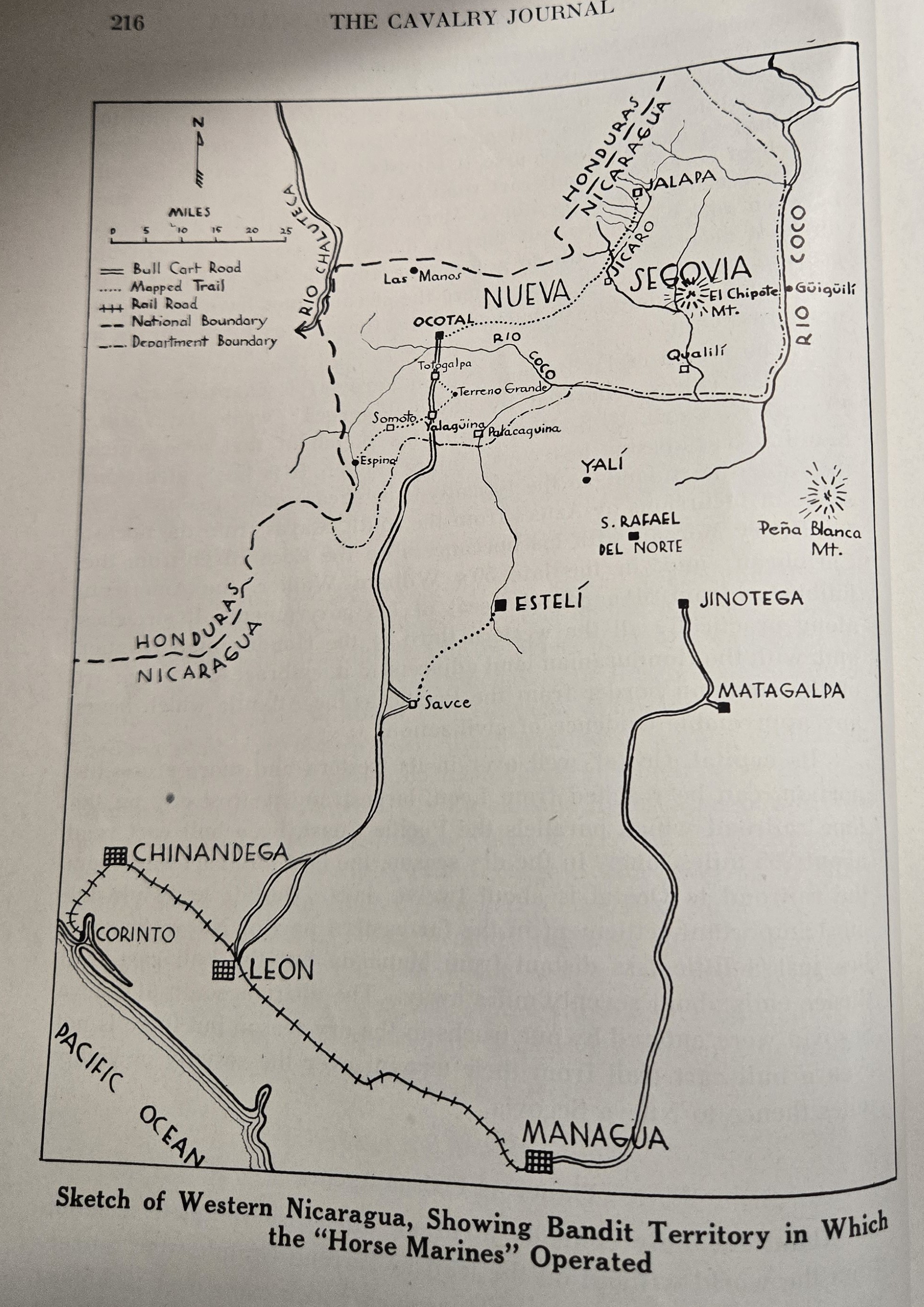
Sketch of Western Nicaragua, Showing Bandit Territory in Which the "Horse Marines" Operated
Dublin Core
Title
Sketch of Western Nicaragua, Showing Bandit Territory in Which the "Horse Marines" Operated
Subject
Map of Western Nicaragua
Description
This map was published in The Calvary Journal to show how USMC were using horses to transverse the country of Nicaragua during the late 1920s. The Map shows the capital, Leon and the port city of Corinto connected by a railroad, but the lines of communication beyond that were tenuous for mechanical travel. Bull cart roads connected the Northern area with the Western area; necessitating the USMC use horses to travel the to certain portions of Nicaragua.
Creator
The Cavalry Journal
Source
Nicaragua, Small Arms Operations in Nicaragua 1927-1928, COLL/3978, Archives Branch, Marine Corps History Division, Quantico, VA.
Publisher
The United States Cavalry Association
Date
April, 1930
Contributor
Jessica Carson
Type
Still Image
Coverage
Nicaragua
Still Image Item Type Metadata
Original Format
Map
Files
Reference
Sketch of Western Nicaragua, Showing Bandit Territory in Which the "Horse Marines" Operated, The Cavalry Journal, The United States Cavalry Association, April, 1930
Embed
Copy the code below into your web page